NOAA
As of Monday morning, if one wanted to grasp the historic nature of flooding from the remnants of Hurricane Helene in western parts of North Carolina and the surrounding areas, the logical place to begin is at the National Climatic Data Center.
This federal office maintains the world’s largest climate data archive and provides historical perspective to put present-day weather conditions and natural disasters into context in a warming world due to climate change.
Unfortunately, the National Climatic Data Center is based in Asheville, North Carolina. As I write this, the center’s website remains offline. That’s because Asheville, a city in North Carolina’s Blue Ridge Mountains, is the epicenter of catastrophic flooding from Hurricane Helene that has played out over the last week. The climate data facility is inoperable because water and electricity services in the region have entirely broken down due to flooding.
At a news briefing this weekend, the governor of North Carolina, Roy Cooper, said flooding from the hurricane represented an “unprecedented” tragedy. Nearly half a million people remained without power, and hundreds of thousands of people lacked drinkable water. At least three dozen people have died from the flooding, and videos have revealed apocalyptic damage in areas where dams failed and highways washed out.
So far from the coast
So how does a region nearly 500 miles from the Gulf of Mexico become devastated by flooding from a hurricane that originated there?
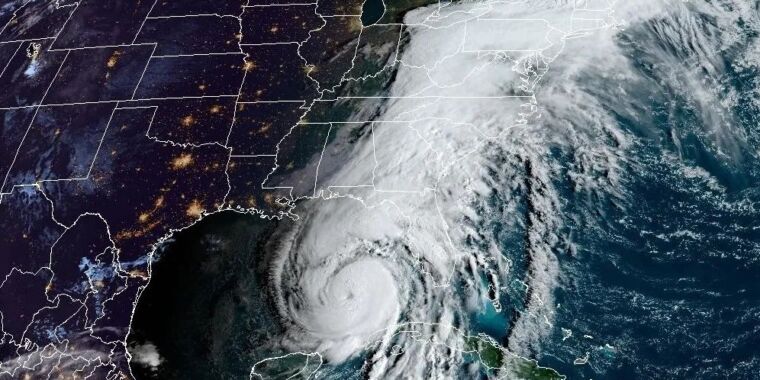
The answer is that Helene’s rapid movement inland—it was one of the fastest-moving storms at landfall in the Gulf of Mexico in recent history—created a massive river of atmospheric moisture and funneled it into parts of North Carolina, northern Georgia, and southeastern Tennessee.
We don’t have any definitive answers yet on how much moisture was sucked northward by Helene and dropped in a deluge on these areas. But by at least one measure, known as integrated vapor transport, the extent of the moisture available for heavy rainfall appears to be historic.
Meteorologist Ben Noll said that the level of moisture transported to western North Carolina is more than 1.5 times greater than any event in the historical record for the region. Using specific humidity, wind components, and pressure differential, the resulting “integrated vapor transport” units are kilograms of water vapor per meter per second. Noll estimates that about 3,000 kilograms (per meter, per second) were transferred into North Carolina at the height of the storm, shattering the previous record of 1,883.
Helene appears to have set records for moisture transported into North Carolina.
Ben Noll
Noll’s work has not been peer-reviewed, and his analysis is necessarily preliminary, but it provides some sense of the unprecedented precipitation unleashed on this region.
Isolated areas of North Carolina received 30 inches (76 cm) or more of rainfall from Helene, and widespread accumulations of 15 inches or more were also reported. While these kinds of rainfall totals are not unprecedented along the Gulf Coast from particularly nasty tropical storms and hurricanes, they are extraordinary for areas well inland.
A rare but not unprecedented event
The hilly terrain in the Appalachians is not built to handle such torrential rainfall, so there have been multiple dam failures and destroyed homes. The National Weather Service issued more flash flood emergencies last week than it ever had before.
Perhaps the only comparable event, in which a storm struck the Gulf of Mexico coast and dropped incredible amounts of rainfall hundreds of miles away, came in 1969 with Hurricane Camille. After making landfall in extreme southeastern Louisiana, Camille tracked over Mississippi, Tennessee, Kentucky, and West Virginia before combining with a frontal boundary over Virginia and producing epic rains of up to 25 inches.
In a single rural Virginia county to the west of Richmond, Nelson County, 133 bridges were washed out. The flooding killed an estimated 153 people.

